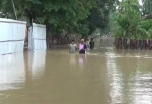
Assam Floods: Central Team Urges Geo-Tagged Photos and Comprehensive Data for Effective Assistance

Guwahati: In the aftermath of the devastating floods in Assam, a seven-member inter-ministerial central team has taken proactive measures to assess the extent of the damage caused to infrastructure, houses, and agriculture. During a crucial meeting with top state government officials, the central team emphasized the importance of accurate data and documentation for providing essential central assistance to the affected regions.
As part of their recommendations, the central team urged the Assam government to submit geo-tagged photographs capturing real-time damage to infrastructure resulting from the floods. This move aims to ensure precise identification and assessment of the areas that require immediate attention and support.
Furthermore, the team suggested that the state authorities compile a comprehensive list detailing the damages inflicted upon houses and agricultural lands due to the floods. By including this data in the final memorandum for central assistance, the government can better convey the magnitude of the impact on communities and the agricultural sector, facilitating a more targeted and efficient allocation of resources.
The central team’s visit to different flood-affected districts allowed them to witness the ground realities firsthand, and this on-spot assessment reinforced the urgency of prompt relief measures. With a focus on accurate information, the collaborative efforts between the central and state governments aim to expedite the recovery and rebuilding process, providing much-needed support to those affected by the natural calamity. As the state prepares its final report, the emphasis on data-driven assistance reaffirms the commitment to addressing the challenges posed by the floods and fostering a resilient and prepared community in the face of future disasters.


